The Kashmir region to the north of Pakistan, sits on a destruction plate margin where the Indian plate is being forces under the Eurasian plate.
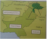
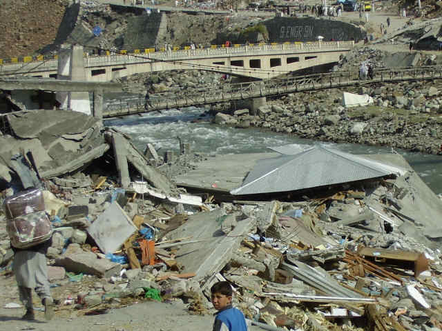
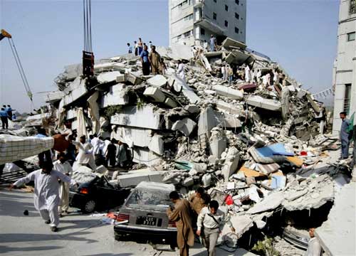
An earthquake occurred in the Kashmir region on 8th October 2005. It happened at 8:50am (local time) and measured 7.6 on the Richter scale. The focus of the earthquake was at a depth of about 16 miles and the epicentre was close to Muzaffarabad. The earthquake resulted from movement along the plate margin which caused a 75km long crack in the earths surface to form. The earthquake caused damage to an area of 30,000km2 - it was felt as far away as Kabul in Afghanistan and Delhi in India. By 27th October 2005 there had been 978 aftershocks measuring at least 4 on the Richter scale. Impacts: Economic: Its been estimated the earthquake cost around US$5 billion in total. Whole villages and thousands of buildings were destroyed. For example 80% of the town of Uri was destroyed. Even in some areas up to 25km from the epicentre, nearly 25% of buildings collapsed and 50% were severely damaged. The total cost of rebuilding has been estimated to be US$3.5 billion. Social: There were around 80,000 deaths, mostly caused by collapsed buildings. This is the 13th highest death toll of any earthquake on record. Hundreds of thousands of people were injured, including around 6000 in India. Around 3 million were made homeless. Water pipelines and electricity lines were broken, cutting off supplies. Landslides buried buildings and people. They also blocked access roads and cut off water supplies, electricity supplies and telephone lines. Diarrhoea and other diseases spread due to lack of clean water. Freezing winter conditions shortly after the earthquake caused more casualities and meant rescue and rebuilding operations were difficult Environmental: Landslides and rock falls occurred throughout the region. Most landslides were relatively small but there were two major landslides that each affected an area of 0.1km2 - one in Muzaffarabad and one in the Jhelum Valley. The Jhelum Valley landslide was the biggest - it was over 1km wide and the debris reached over 2km from the top of the slide. The debris created a dam at the bottom of the valley that blocked two rivers where they joined. As a result of the earthquake and surface rupture, the ground shifted by more than 5m in some areas of Kashmir. |
Response:
Help didn't reach many areas for days or weeks people had to be rescued by hand without any equipment or help from emergency services. Tents, blankets and medical supplies were distributed within a month, but not to all areas affected. The Pakistani government set up the Federal Relief Commission (FRC) and the Earthquake Reconstruction and Rehabilitation Authority (ERRA) to coordinate activities with other international agencies and non-governmental organisations. International aid and equipment such as helicopters and rescue dogs were brought in, as well as teams of people from other countries. An estimated US$5.8 billion of foreign aid was provided by the international community in response to the disaster. Around 40,000 people were relocated to a new town from the destroyed town of Balakot. Government money has been given to people whose homes had been destroyed so they can rebuild them themselves. Training has been provided to help rebuild more buildings as earthquake resistant. New health centres have been set up within the area. Hazard Management: There was no local disaster planning in place. Buildings were not designed to be earthquake resistant. Many houses were structurally poor because people could afford better buildings. However, even government buildings in areas such as Muzaffarabad were structurally unsound and so were damaged in the earthquake. Communications were poor and there were few roads of which most were badly constructed. |
My Site